


Smart Import: many files, one map
The parcel list in Excel, the GPS points from the last walk through the forest, the map file of skid trails from the contractor: your operation's data is already there. It is just scattered across the office computer, every file in its own format. With Smart Import you bring all of it onto one shared map in Dynamic Forest in one go. No retyping, no reformatting, no detour through GIS.
No more retyping and converting
Sound familiar? One table lists the tree species as “HB”, the next as “hornbeam”. The parcel list counts in square metres, Dynamic Forest in hectares. The GPS device stores points in a different coordinate system from the contractor, and the Excel list has no boundaries at all.
Until now that meant asking what abbreviations mean, converting units, checking coordinates in a GIS program and rebuilding columns by hand. Or simply typing everything in again. A single typo or a wrong coordinate system, often without an understandable error message, and you were back to square one. Hours at the desk that are missing out in the forest.

This is how easy it is now
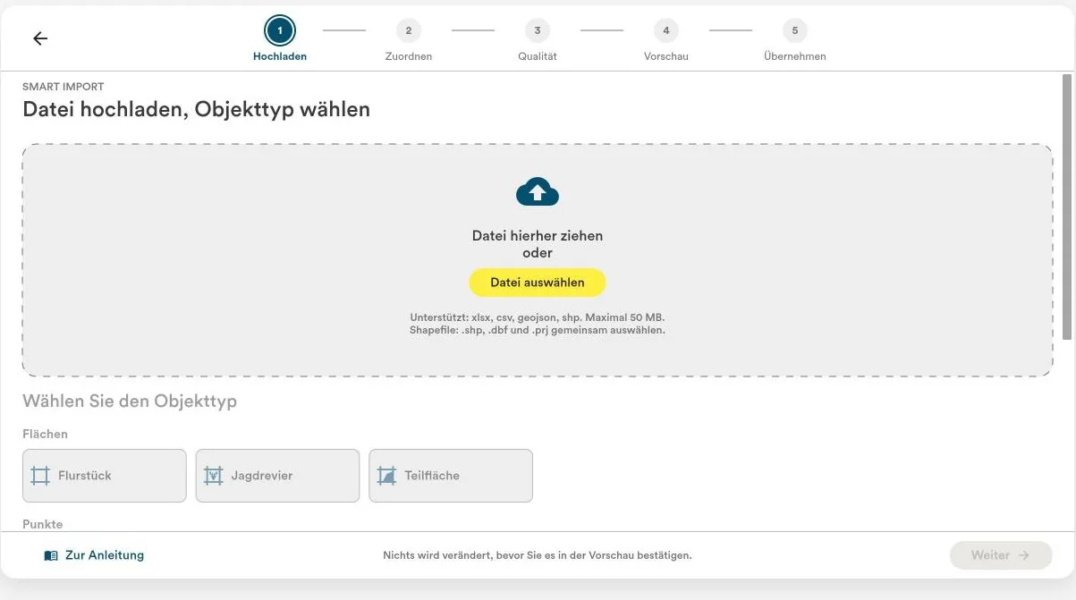
You upload the file as it is and say what it should become: parcels or sub-areas, skid trails or roads, habitat trees or calamities. Smart Import takes care of the rest:
- AI matches the columns. You see every suggestion and can change it.
- Abbreviations resolve themselves. “HB” becomes “hornbeam”. If the AI is unsure, the import asks once, and your answer applies to every row with the same abbreviation.
- Units and coordinates add up. Smart Import recognises square metres and converts them to hectares if you want. It detects the coordinate system automatically and converts Gauss-Krüger and UTM on its own.
- You see problems before they become problems. Whatever does not fit is collected before the import, with row and value. You decide: adjust the mapping, leave the value empty or skip the row. If it cannot read a file at all, it tells you why and what to do.
In short: you make the decisions, Smart Import does the legwork.
Parcels without coordinates? The boundaries come from the cadastre
A plain list of parcel numbers is enough: in 14 German federal states, Smart Import fetches the boundaries straight from the official cadastre. The cadastral district number and the parcel number are all it needs. No tracing, no searching the geoportal, and every parcel sits on the map exactly as it is recorded in the cadastre.
Note: Bavaria only releases its boundaries under a paid contract, and Bremen is not connected yet. For parcels there, upload a file that contains the boundaries.
New data? Just add it
Your operation does not stand still, and neither does your map. The next forest management plan brings new sub-areas, the next inspection new habitat trees or calamities. You add them the same way, instead of keeping a second list next to the old one. Smart Import updates existing objects when the row contains their Dynamic Forest ID from an earlier export or matches their geometry.
Smart Import is included in all plans and runs in the web version of Dynamic Forest. It reads Excel and CSV files, GeoJSON and shapefiles up to 50 MB and 5,000 rows. Which files are supported is explained in the knowledge base article Welche Dateien kann ich mit dem Smart Import hochladen? (in German).
Less office work, more time in the forest
Bring your own parcel list. In a demo you will see live how it becomes a map in Dynamic Forest.
Book a demo